

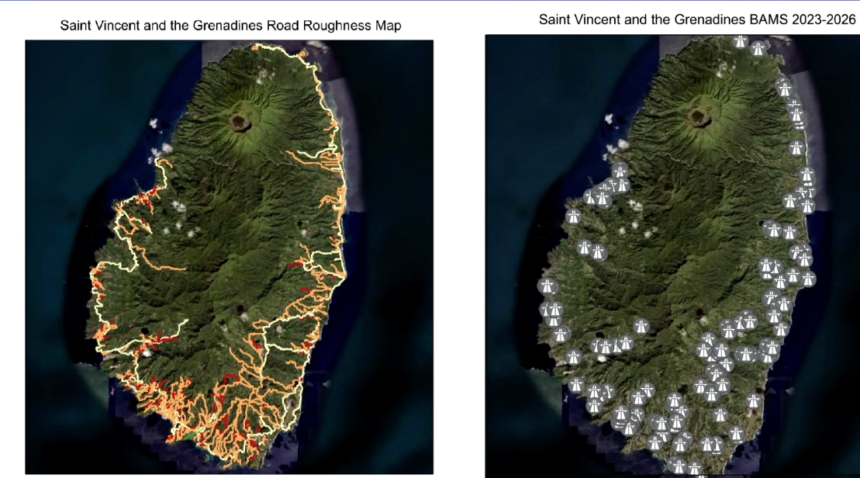
Miguel Francis, presenting on behalf of the Buildings, Roads and General Services Authority (BRAGSA), has unveiled comprehensive geographic information systems (GIS) mapping showing that 69% of surveyed roads in St. Vincent and the Grenadines fall within fair, poor, or very poor condition.
According to 2023 road roughness data collected by BRAGSA’s Road Asset Management (RAM) team using an Eimeter, 21% of the national road network is classified as ‘very poor,’ 21% as ‘poor,’ and 27% as ‘fair’. Visually displayed via ArcGIS software, the national road roughness map is dominated by yellows, oranges, and reds, highlighting widespread surface deterioration across highways, secondary roads, village roads, and feeder routes. In addition, the RAM team successfully surveyed 207 bridges across St. Vincent and the Grenadines.

To address these severe infrastructure challenges, BRAGSA is developing pothole hotspot maps by correlating traffic count density, road class, surface materials (asphalt, concrete, or unpaved), and soil classification data from its materials testing laboratory.
Furthermore, the agency is finalizing a digital Road Defect Register that will allow both BRAGSA staff and the general public to log defects such as potholes, rutting, and alligator cracking. This platform will eventually feature a live public map on BRAGSA’s website providing real-time updates on potholes, ongoing repair works, and maintenance schedules.