

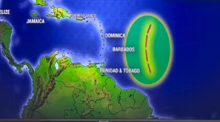
Meteorologists are closely monitoring a new tropical wave currently moving through the Atlantic, which is expected to reach the eastern Caribbean islands by late Monday night and into Tuesday morning. While this system brings the potential for much-needed rainfall, experts indicate it is unlikely to develop into a significant tropical threat.
Timing and Affected Areas According to the sources, the next tropical wave is timed to move through the Atlantic passageways starting late Monday, August 17.

By Tuesday morning, the system is projected to impact a stretch of islands including Dominica, Martinique, St. Lucia, Barbados, St. Vincent and the Grenadines, and Grenada. While the wave will increase the chance of showers across these areas, the rain is expected to be “broken,” meaning some islands may see downpours while neighboring islands remain dry.
Residents in the path of the wave can expect the following impacts:
- Rainfall Totals: Some localized spots could receive between 50 to 75 millimeters (approximately 2 to 3 inches) of rain.
- Marine Impacts: Sea levels are expected to be elevated in the Atlantic passageways as the wave moves in, with some areas potentially seeing seas of 7 to 12 feet.
- Weakening Trend: The wave is expected to weaken as it approaches, with some models suggesting it may “fizzle” or become less organized by Tuesday afternoon due to environmental factors.
Despite the active appearance of recent “blobs” of moisture in the Caribbean, several factors are preventing these waves from organizing into hurricanes. High wind shear, strong winds aloft that tilt or “knock off” the tops of developing storms is currently prevalent across the region. Additionally, the presence of dry air and Saharan dust continues to hinder tropical organization.
While the waves moving through early this week pose no immediate tropical storm threat, meteorologists are keeping an eye on a separate tropical wave expected to emerge off the coast of Africa later in the week. Some early models suggest this future system may have a slightly higher chance of development as it moves into the East Atlantic near Cabo Verde.