

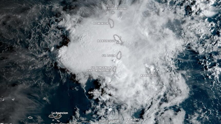
An active tropical wave moving across the region has brought heavy rainfall to St. Vincent, recording 130.2 mm of rain over a 24-hour period.
According to the official local weather report issued at 6:00 AM on Tuesday, October 6, 2026, by the Government’s Meteorological Office at Argyle International Airport, overcast conditions and showers continue to affect the island nation.

Meteorological officials have issued a weather advisory warning instructing residents and motorists in high-risk zones to exercise extreme caution. The advisory specifically highlights risks for individuals located in or traveling through areas prone to flash flooding and landslides, as well as those near rivers and streams.
As of 6:00 AM, meteorological readings recorded a local temperature of 24.0 °C, a relative humidity of 96%, and barometric pressure at 1011.2 mb. Winds were observed from the south-southeast at 15 km/h (9 mph). The preceding day reached a maximum temperature of 30.3 °C before dropping to an overnight minimum of 21.6 °C.
For the morning forecast period between 6:00 AM and 12:00 PM on Tuesday, skies will range from cloudy to overcast. The weather pattern includes pockets of moderate to heavy showers, periods of rain, and isolated thunderstorms early on, before easing to mostly cloudy skies with a few remaining showers.
Winds during the period are expected to blow from the east-northeast to east-southeast at 20 to 30 km/h (12 to 19 mph), with stronger gusts occurring near shower activity.