
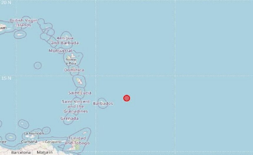
A magnitude 4.1 earthquake was recorded east of the Windward Islands early Sunday morning, November 1, 2026, according to official manual location data released by the University of the West Indies Seismic Research Centre (UWI, SRC).
The seismic event occurred at 01:14 local time (05:14 UTC) at a relatively shallow depth of 49 kilometers beneath the seabed. The epicenter was pinpointed at latitude 13.52°N and longitude 58.04°W.
Proximity to Regional Population Centers
The offshore tremor occurred in the Atlantic waters east of the Lesser Antilles arc. The UWI Seismic Research Centre noted the following distances and compass headings from major nearby capitals to the epicenter:
Bridgetown, Barbados: 180 km east-northeast (ENE)
Castries, Saint Lucia: 331 km east (E)
Kingstown, Saint Vincent and the Grenadines: 356 km east (E)
The event represents another verified seismic reading detected across the Eastern Caribbean’s active tectonic boundary by regional monitoring instruments.