

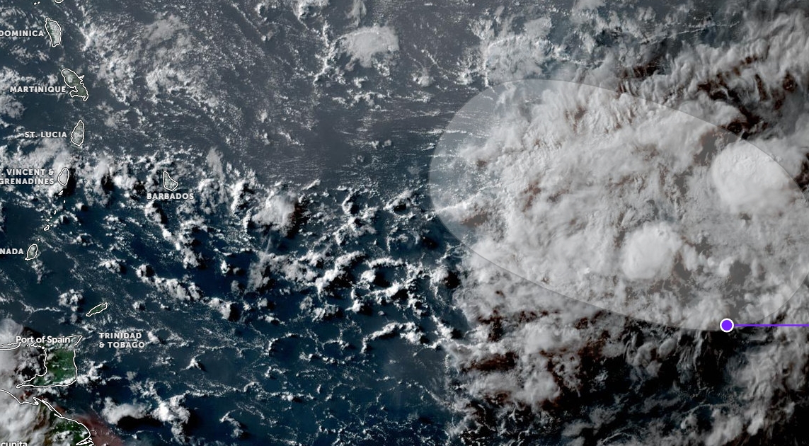
Unstable conditions are affecting our islands generating cloudy skies and pockets of showers. Meanwhile at 8am this morning, a tropical wave with a 20% chance of tropical cyclone formation was located approximately 700 miles ESE of SVG.
This feature is expected to influence the weather pattern across SVG during the upcoming days. Instability associated with this wave could begin to affect our islands as early as Tuesday afternoon. Residents should remain alert.
The SVG Meteorological Services will continue to monitor this feature and provide the necessary updates.
Moderate to fresh (~20 -30 km/h) east south easterly to east north-easterly trades are crossing the islands with gusts near showers.
Seas are slight to moderate in open water with swells peaking near 1.0m on western coasts and peaking at 2.0m on eastern coasts. No signifcant Saharan dust haze intrusion is anticipated during this forecast period.


