

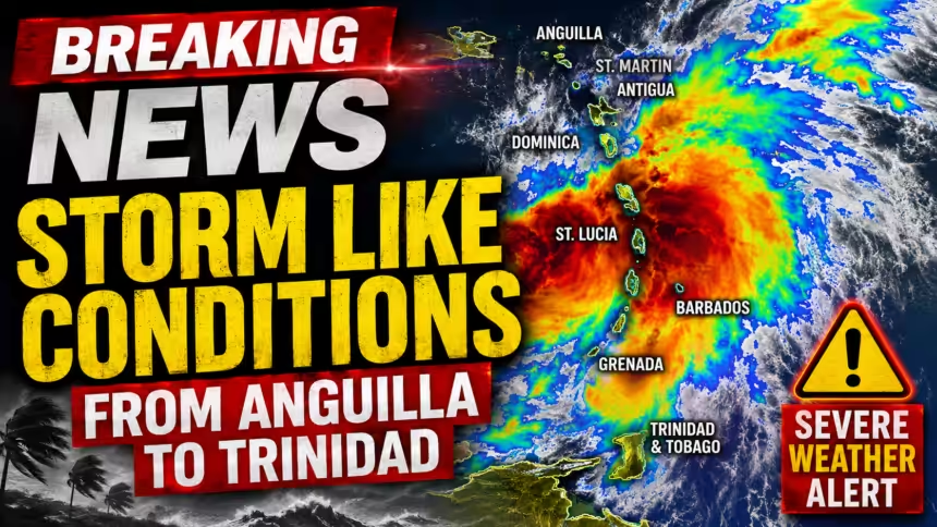
A significant tropical disturbance is moving into the southeastern Caribbean tonight, Friday, August 14th, bringing a “big blob” of moisture that is expected to trigger heavy rainfall and gusty winds across the region. While meteorologists do not expect the system to develop into a named tropical storm, they warn that its impacts could still be substantial.
The disturbance is trending southward, with the heaviest weather expected to affect the southeastern Caribbean through tonight and into Saturday.

Residents in Barbados, Trinidad, Tobago, St. Lucia, St. Vincent and the Grenadines, and Grenada should prepare for stormy conditions and heavy downpours that may wake them up overnight. Showers have already begun moving into Guyana and northeastern Venezuela, and the rain is expected to pick up in Dominica and Guadeloupe as the system progresses.
Forecasters emphasize that a system does not need a name to cause significant problems. Key threats include:
- Gusty Winds: Isolated pockets could see tropical storm-force gusts reaching 80 km/h (50 mph).
- Heavy Rainfall: Rainfall totals in the southeastern Caribbean could reach up to 150 millimeters, leading to isolated flooding.
- Mudslide Risk: The intensity of the downpours has raised concerns for mudslides, particularly in spots like St. Lucia, Grenada, and southern Trinidad.
The system is a “fast mover” and is expected to weaken substantially as it travels further into the Caribbean. By Saturday night, it is projected to move south of Haiti, the Dominican Republic, and Puerto Rico.
While this weakening is good news for storm development, it is “bad news” for the northern Caribbean islands—including Antigua, Barbuda, St. Kitts, Nevis, and Jamaica—which are in desperate need of rain but are likely to be missed by this particular system.