

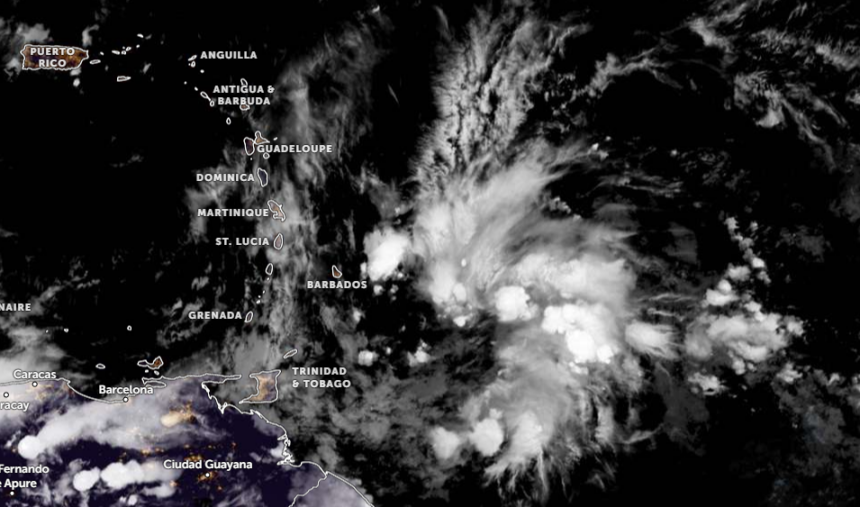
Tropical wave activity is expected to cross St. Vincent and the Grenadines on Tuesday, October 6th, bringing periods of light rain, pockets of moderate showers, and thunderstorm activity.
The St. Vincent and the Grenadines Meteorological Services issued a 72-hour weather outlook on Sunday, October 4th, placing a “Be Alert” weather advisory in effect for Tuesday. Residents and motorists near rivers, streams, and areas prone to flash flooding and landslides are strongly advised to remain vigilant as the wave passes.

Ahead of the approaching tropical wave, weak atmospheric instability remains across the islands alongside a noticeable film of haze.
Monday, October 5th: Conditions will be partly cloudy to cloudy with a few showers and isolated thunderstorms. Winds will blow gentle to moderate from the northeast at 15 to 25 km/h. No weather advisories are in effect for Monday.
Tuesday, October 6th (Wave Arrival): Skies will become occasionally cloudy with scattered showers and thunderstorms. Winds will shift to south-southeasterly, briefly weakening to a light breeze of 5 to 10 km/h before re-intensifying to 20 to 30 km/h by late Tuesday.
Wednesday, October 7th: Conditions will turn partly cloudy to cloudy with a few scattered showers and isolated thunderstorms, with no active advisories.