
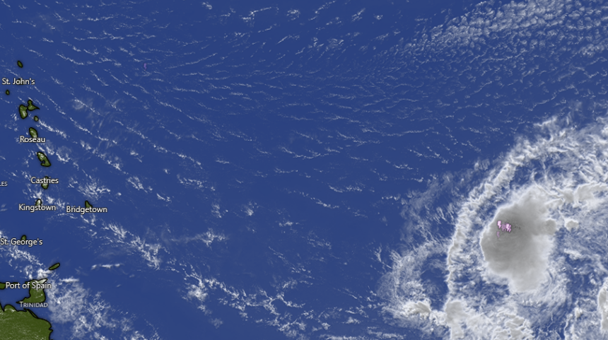
Forecasters are closely monitoring a tropical wave located approximately 1,000 miles east of the Lesser Antilles that is showing increasing signs of organization. The system is currently producing concentrated showers and thunderstorms and is expected to develop into a tropical depression within the next day or two.
Despite the high probability of formation in the near term, experts indicate that the window for intensification will be brief. As the system moves westward across the tropical Atlantic, it is forecast to encounter strong upper-level winds and dry air by late Friday.
These hostile environmental conditions are expected to stifle further organization and effectively end its opportunity to develop into a more powerful storm.
According to the latest outlook, the system maintains a high chance of development:
- Formation chance through 48 hours: 80 percent.
- Formation chance through 7 days: 80 percent.
While the system is expected to be short-lived, residents and interests in the Lesser Antilles are advised to monitor its progress closely. Regardless of whether the system officially becomes a tropical depression, it is expected to bring gusty winds and areas of heavy rain to the islands starting Friday night and continuing into Saturday.
Local authorities emphasize that even a weak or disorganized system can produce significant rainfall and wind gusts, and precautions should be taken ahead of the system’s arrival this weekend.