
In the week preceding the historical peak date of the Atlantic hurricane season on Sept. 10, our attention turns to Invest 91L.
This particular Invest — 91L — originated as an easterly wave over the African continent and moved into the Atlantic waters south of Cabo Verde at the beginning of the week. Since then, it’s been showing signs of very slow development. A low-pressure center formed on Thursday, and as of 2 p.m., NHC indicated that there’s a 90% chance of it strengthening into a tropical depression or storm, possibly as soon as this weekend.

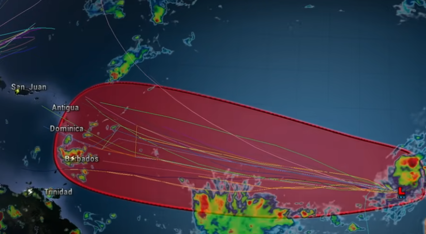
With 91L moving west at a relatively low latitude of 12 degrees north, residents of the eastern Caribbean are watching it closely. Global forecast models have yet to reach a consensus about the future of the system, with the American GFS turning it harmlessly north before the Antilles, the European pointing straight at the Leeward Islands, and the Google DeepMind artificial intelligence model — which did quite well in forecasting Major Hurricane Erin’s track — taking it to the Windward Islands.
Caribbean residents will have plenty of time to observe Invest 91L’s behavior because the disturbance is only moving at about 10 mph. Logically, that means that U.S. mainland residents have even longer to monitor the tropical wave. It’s approximately two weeks’ travel away! It may never reach North America, but that’s not a call we can make today.
Should 91L develop into a named tropical storm, Gabrielle is the next name on the list.
