

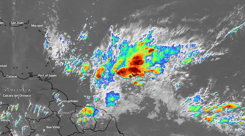
Moisture levels are expected to increase as a trough system approaches the islands, bringing cloudiness, showers and thunderstorms across St. Vincent and the Grenadines (SVG) over the next few days…
Residents and motorists in areas prone to flash-flooding and landslides or near rivers and streams should be alert.
Moisture levels are likely to decrease across SVG by Saturday evening, as slight-haze moves across our area.
Moderate (20 – 25km/h) breeze across our islands are expected to increase during Friday night and Saturday, becoming occasionally strong (30 – 40km/h)…Be aware!

Wind directions could vary between east northeast and southeasterly in some locations.
Sea conditions are slight to moderate in open water, with swells near 0.5m(1.5ft) west of our islands and 1.5m(5ft) east of our islands.
Northwesterly swells are expected west of SVG during Thursday and Friday and gradually rising during Friday night.
Swells could range 1.5m(5ft) to 2.5m(8ft) across SVG by early Saturday…Small-craft operators and sea bathers should exercise caution for above normal swells and gusty winds.
