
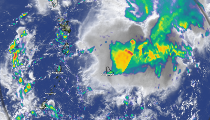
The St. Vincent and the Grenadines Meteorological Services continues to monitor a strong tropical wave located just east of the Windward Islands.
While satellite data indicates that the wave does not appear to have a surface circulation, an Air Force Reserve reconnaissance aircraft is currently investigating the area.
This system could still become a tropical depression during the next day or two while it moves quickly westward at about 20 to 25 mph, passing through the Windward and Leeward Islands later today (Sunday) and early Monday.
Current model guidance suggests that there is medium chance (40%) of development during the next forty-eight (48) hours and the next seven (7) days.
Regardless of development, this system is likely to generate cloudy skies and trigger pockets of moderate to heavy showers and thunderstorms across St Vincent and the Grenadines by evening today (Sunday) into Monday. In addition, surface winds are strong to near-gale force, with 8-11 ft seas. A marine advisory is already in effect for above normal sea swells for the coastal waters surrounding SVG.
The system is expected to reach the central Caribbean on Tuesday 26th August 2025, where conditions are expected to become less favorable for additional development. An Air Force reconnaissance aircraft is scheduled to investigate the system later today, if necessary.
Flash flood watches or warnings may be issued within short notice.
Residents are strongly advised to keep informed on the progress of this system.
